|
|
|
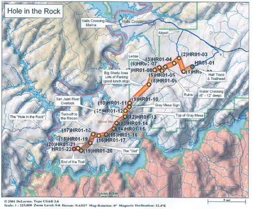
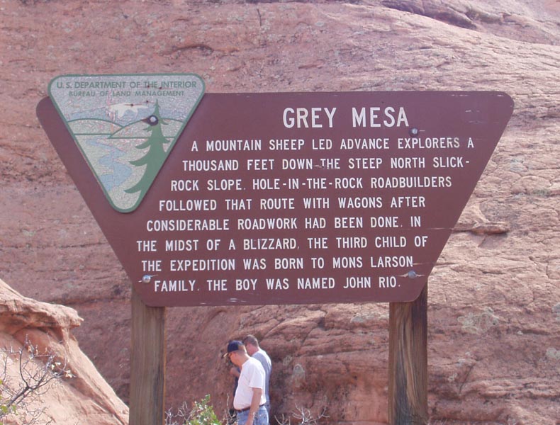
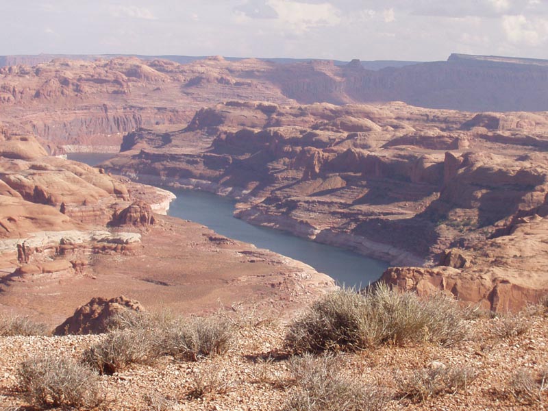
The Hole in the Rock Trail is located in South Central Utah, about 60 due West of Bluff, nestled between two large forks of Lake Powell. To get to the trailhead from Bluff, take US 191 north towards Blanding for approximately 20 miles. Turn left on SR 95 and travel west for about 38 miles. Turn left (southwest) on SR 276 and travel 45 miles all the way to Halls Crossing Marina. This is 15 miles past the turnoff to the trailhead, but this is your last chance for 2+ days to get gas and supplies! Regardless of how “good” of gas mileage you think you get, don’t skip this opportunity to top off your tank! Now head back East on SR 276 for about 15 miles and bear right at the fork onto Nokai Dome Road. Turn right at the “T”, still on the same road. At just over 4 miles, you should run into the old rusted out Half Track off to the right side of the road. This is a good spot to camp the first night. The Hole in the Rock trail is relatively flat at around 4,500 – 5,000 feet in elevation. It traces a portion of the trail built by Mormon pioneers in the spring of 1880 who were answering a mission call to colonize the southeastern section of the territory. The trail provided a crucial link for one year before the most rugged stretches were bypassed with the opening of Hall’s Crossing. As winter approached at the end of Nov 1879, 250 men, women, and children, with 80 wagons and 1,000 head of cattle, found themselves up against terribly broken, seemingly impassable terrain. The settlers had been en route for more than two weeks when they reached the 1,200-foot-deep Colorado River gorge, sixty-five files southeast of Escalante. For six weeks, the men labored on a wagon road down the sandstone cliffs to the Colorado River. Built by chiseling and blasting a path through a steep crevice name the Hole-in-the-Rock, the road stands today as a testament of pioneer ingenuity and determination. After driving the wagons through the Hole-in-the-Rock, and ferrying across the 300-foot-wide river, the emigrants proceeded east out of the river gorge. On 6 Apr 1880, after another ten weeks of grueling labor in harsh winter conditions, the missionaries reached a sandy bottomland along the banks of the San Juan River where they established Bluff City. In all, the trek took six months. Food supplies were depleted, and teams had been worn to the point of exhaustion. Two babies were born en route, and miraculously, no one had died. The Hole in the Rock Trail is nearly 25 miles one Difficulty Rating: Two (2) Moderate
Click HERE for a FULL-SIZE printable map Here are a couple pictures from the Hole in the Rock Trail.
Notice: Off-highway travel is by its very nature potentially dangerous and could result in property damage, injury, or even death. If you drive any of the trails on this web site, you acknowledge these risks and assume full responsibility. You are the final judge as to whether a trail is safe to drive, whether your vehicle is capable of the journey, and whether your skills are up to the challenge. The publisher of this web site disclaims any and all liability for property damage, bodily injury, or death that could occur to you or any of your passengers. To the best of my knowledge, the information contained on this page was accurate as of the time I road this trail during the Fall of 2003. However, things change over time. And portions of this trail may no longer be legally accessible to motorized vehicles. Therefore, please be good stewards of our sport--always stay on designated trails . . . and always, always remember to Tread Lightly!
|
|
|